Loud Dam on M-65
The third dam built on the Au Sable sits where the state highway crosses the river, named for a lumber family that once owned much of the logged-over valley.
- ALLOW
- About 20 to 30 minutes
- FROM OSCODA
- About 45 minutes west
- PARK OR STAND
- The public area by the dam where M-65 crosses
- NEXT LEG
- North on M-65, then west on Bamfield Road
- BEST MONTHS
- May to October
- BRING
- Camera, fishing licence, a printed map for later roads
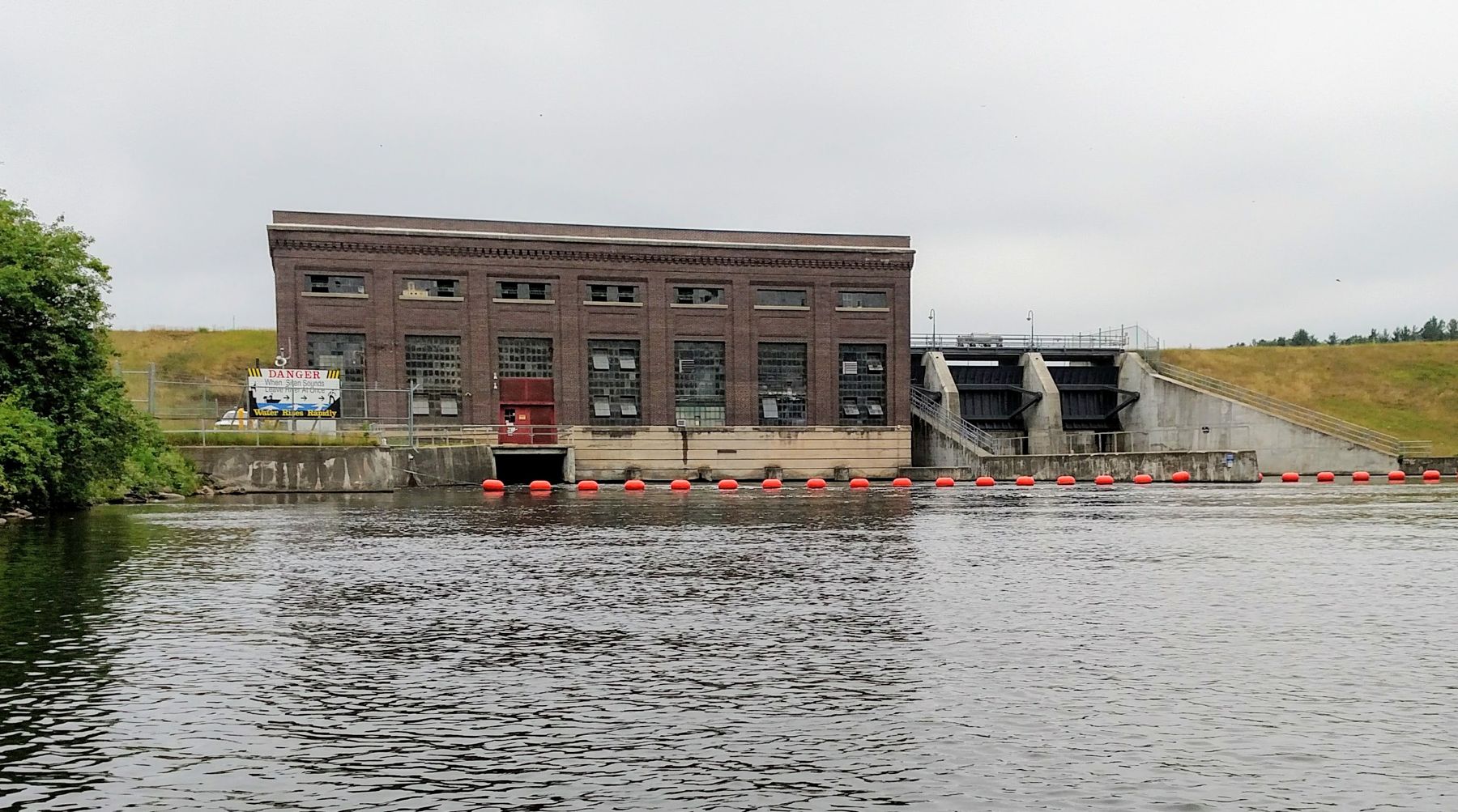
River Road ends its run along the south bank at M-65, and here the highway crosses the Au Sable right beside a dam. Loud Dam is the easiest of the upstream dams to reach, and the busiest, because the road delivers you to it whether you meant to stop or not.
From lumber money to hydro power
Loud Dam opened in 1913, the third of the six to be built, after Cooke and Five Channels. Its name comes from the Loud family, lumbermen whose holdings shaped this part of the valley. Edward F. Loud in particular bought up much of the cutover Au Sable land between 1900 and 1906, after the pine was gone and the ground was thought to be worth little.
That land became the setting for the power company's dams, and the family's name stayed on this one. The dam has a 27-foot head, the height the water drops through the plant, and two 2,000 kW generators. It is still in use, and the brick powerhouse is a clear reminder of how quickly the valley changed hands from timber to power in the space of a decade.
Standing at the crossing
A public area near the dam gives you a look at the powerhouse and the water below it. The river leaves the plant quickly here, and anglers are a common sight on the banks in season. Upstream, the pond behind the dam spreads west into the forest.
07ALSO WORTH THE DETOUR · Huron National Forest trails · stop 7Rollways and the Westgate deck over Loud Dam PondFor a higher view of Loud Dam Pond, the Westgate overlook at the west end of the byway and the Rollways area nearby both sit on bluffs above it. They make a good detour if you have time, and they are covered on the Huron National Forest tour.
The slopes around the pond also show how far the valley has come since the Louds bought it. Much of that land was stumps and sand at the turn of the century; today it is pine and hardwood again, and a large share of it is public forest.
Time here and the change of route
Twenty to thirty minutes covers the dam itself. Add half an hour if you go up to the Westgate deck. Summer and early autumn are the best months, and late September into October can be striking from the overlooks. In winter the highway is maintained, so this is one of the easier dams to see in snow.
Loud Dam is not part of the short day, which stays on the lower river. It does mark a turning point in the full tour: from here you leave River Road behind and continue north and west on M-65 and county roads, some of them gravel. Check your map before you go on.
North toward Alcona Pond
You arrive from Five Channels Dam, a few miles downstream. The next stop on the River Road tour is Au Sable Vista, reached by heading north on M-65 and then west on Bamfield Road to a deck high above Alcona Pond.
Every photograph here is credited, with its licence, on who took the photos.