Alcona Dam, the last one built
The fifth dam upstream took seven years to finish, held up by shifting sand and the First World War, and it was renamed for the county along the way.
- ALLOW
- About 20 to 30 minutes
- FROM OSCODA
- About 55 minutes west
- PARK OR STAND
- The public area beside the powerhouse below the dam
- NEXT LEG
- About 30 to 40 minutes west by county roads and M-72 to Mio
- BEST MONTHS
- June to October
- BRING
- A printed map, water, insect repellent
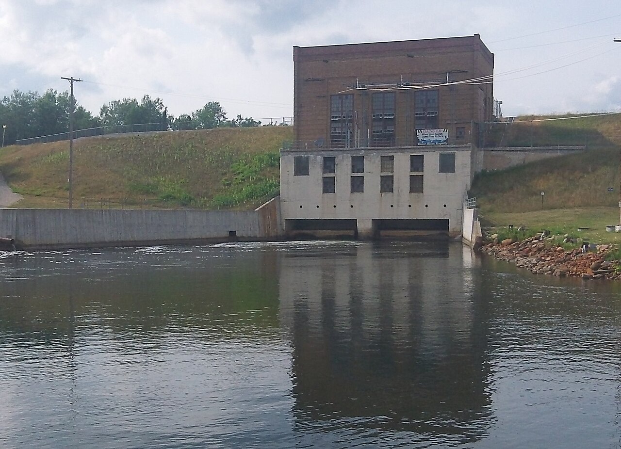
The road to Alcona Dam feels farther from everything than the other stops, and in a sense it is. This is deep in the forest of Alcona County, at the foot of the pond you looked down on from Au Sable Vista. The powerhouse sits low beside the river, with a long grassy embankment holding back the water.
Seven years to finish a dam
Work began here in 1917 on what was then called Bamfield Dam. It did not go smoothly. The ground was unstable sand, which made building an embankment difficult, and the First World War slowed the work further. The dam was not finished until 1924, making it the last of the six Au Sable dams completed, even though it is not the farthest upstream.
By the time it opened, it carried a new name, Alcona, after the county. It is an embankment dam, with earth rather than concrete doing most of the holding, and the plant is rated at 8 MW. It sits in Curtis Township and still generates power today.
Standing below the embankment
A public area beside the powerhouse lets you look at the plant and the water leaving it. The brick powerhouse is plain and solid, and the grassy slope of the embankment rises beside it, a reminder of how much earth it took to hold this pond in place on such shifting ground. Below the dam the river resumes its course toward Loud Dam Pond and the lower valley.
01ALSO WORTH THE DETOUR · Mio and the upper river · stop 1The Gabions, where wire baskets hold the bankUpstream of the pond, the Au Sable National Scenic River runs about 23 miles to Mio, a long undammed stretch popular with paddlers. Several Forest Service sites sit along it, and the upper river is covered on its own tour.
Behind the dam, Alcona Pond spreads out as a broad sheet of water with wooded shores and quiet bays. If you came from Au Sable Vista, look back up at the ridges and work out where the deck stood. From down here the size of the embankment is easier to judge than from above, and so is the effort it took to build it on sand.
Timing and conditions
Allow twenty to thirty minutes. Summer and early autumn are the easiest months to visit; the county roads that lead here can be rough in spring thaw and are not all reliably cleared in winter, so check conditions if you come outside the warm season. Bring insect repellent in early summer, when the woods near the water are buzzing.
Alcona Dam is not part of the short day. It belongs to the full upstream tour, and with Au Sable Vista it makes the most remote pair of stops on the route.
The last leg to Mio
You reach Alcona from Au Sable Vista, a few miles back along Bamfield Road. The final stop, Mio Dam, is about half an hour or more to the west by county roads and M-72. The scenic river between the two dams, where the Gabions sits, belongs to the upper-river tour. The River Road tour ends at Mio.
Every photograph here is credited, with its licence, on who took the photos.