McMasters Bridge, the turning point upriver
The tour reaches its farthest point in Crawford County, at a state launch beside McMasters Bridge on the main Au Sable, about halfway between Mio and Grayling.
- ALLOW
- About 20 to 30 minutes
- FROM OSCODA
- About 1 hour 30 minutes west
- PARK OR STAND
- The state access lot east of McMasters Bridge Road
- NEXT LEG
- Back east on M-72 past Mio, then south to Mack Lake
- BEST MONTHS
- Late May to early October
- BRING
- Binoculars, a snack, fishing licence if casting
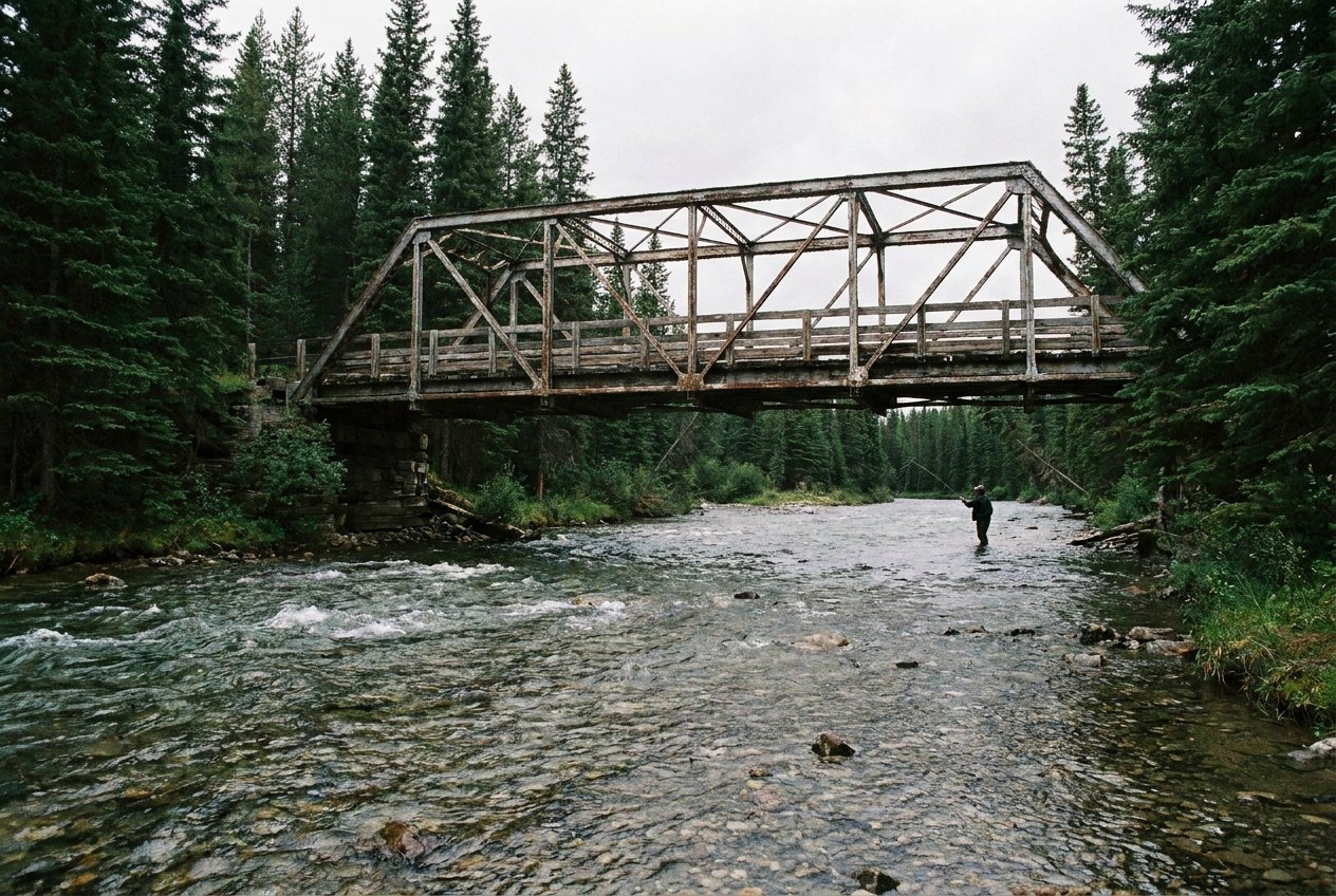
This is as far up the river as the tour goes. McMasters Bridge carries McMasters Bridge Road over the main Au Sable about 4.1 miles north of M-72 and roughly 16 miles east of Grayling. A state access site on the east side of the road gives you a concrete launch and a clear view of the river. Beyond here the Au Sable belongs to the Grayling country, and to another tour.
Across the line into Crawford County
Every other river stop on this trip is in Oscoda County. McMasters Bridge is just over the line in Crawford County, the county of Grayling and the river's upper branches. The landscape does not change at the boundary: it is the same sandy pine country, the same clear water and the same scattering of cabins along the banks. But the distance from Oscoda does add up, and this is the point where most of the day's driving is behind you.
The stretch of river around McMasters is classic upper Au Sable, wider than a creek, shallow enough in places to wade, and cold all summer. It is the kind of water that made the river's reputation among trout anglers.
A concrete launch on the main stream
The state access has a concrete launch, the kind built to handle boats in all water levels, and a parking area beside it. Paddlers and anglers use it to put in or take out, and in season you may see the long wooden riverboats the Au Sable is known for. If you are not going on the water, walk to the edge of the launch and look up and down the river; the bridge gives a good frame to the view.
08ALSO WORTH THE DETOUR · Tour 8Grayling, Hartwick Pines and the head of the riverKeep clear of the ramp if anyone is loading, and do not block the lot with a parked car. Mornings and evenings are the quiet hours here, when the light is low on the water and you are most likely to see a heron working the shallows or trout rising to insects in summer.
How long at the far end
Twenty to thirty minutes is enough. Late spring and summer bring the most people on the water. Early autumn is quieter, with colour in the hardwoods. In winter, McMasters Bridge Road and the access may be snow-covered, so check conditions first.
McMasters Bridge is not one of the five short-day stops. It is the long drive of the day, about an hour and a half from Oscoda, and best saved for a full day out.
Turning back east for the jack pine
You arrive from Parmalee Bridge, downstream to the east. From here the tour turns around. Head back to M-72 and east past Mio, then south into the pine plains for the Mack Lake burn. The full route is set out on the Mio and upper river tour page.
Every photograph here is credited, with its licence, on who took the photos.