The Black River mouth
At the north-east corner of Alcona County a small river finds the lake beside an old village, a public beach and a boat launch the sand keeps trying to close.
- ALLOW
- About 30 to 45 minutes
- FROM OSCODA
- About 50 minutes north
- PARK OR STAND
- The public access lot at the river mouth
- NEXT LEG
- A few miles north, the last stretch on sand, to Negwegon
- BEST MONTHS
- June to September
- BRING
- Swimsuit, towel, fishing rod, sandals
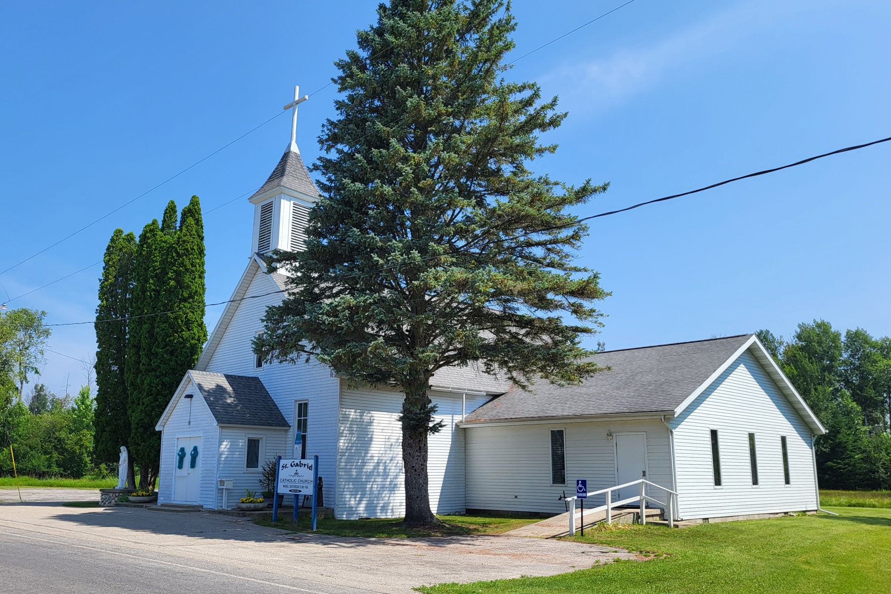
The road to Black River runs through woods and then opens onto the lake, a long way from any highway noise. A small river slides out of the trees and into Lake Huron beside a scatter of houses and a white frame church. This was once a village in its own right, about twelve miles from Harrisville in the far north-east corner of Alcona County, and it is the seventh stop on the tour.
A village named for its river
Black River took its name from the stream that enters the lake here. Like the other settlements on this shore, it grew in the lumber years, when a river mouth meant a place to land logs and load boats. The village has long since thinned out, but the river, the shore and a few older buildings, such as the church on the main road, remain.
The state keeps a public access at the mouth, with a boat launch and a beach. The river is small and Lake Huron's currents carry a steady load of sand along the shore, so the mouth keeps silting up and has to be dredged to keep boats moving in and out. Watching the river push through the sand to the lake gives you a clear picture of how restless this coast is.
08ALSO WORTH THE DETOUR · Tawas Bay and Tawas Point · stop 8Gateway Park, where the Tawas River meets the bayBeach, launch and river
Most visitors come for the beach. It is a quieter piece of sand than the ones in Harrisville, and on summer afternoons the shallow water near the mouth warms faster than the open lake. Anglers use the launch to reach Lake Huron, and some fish the river itself. Stand where the river meets the lake and look north and south along the shore: in both directions the coast runs on in long curves of sand and trees.
Conditions at the mouth change with the season and the weather. After storms the channel can shift, and after dredging it may look different from one year to the next. Swimmers should keep to the calm side of the mouth and away from the channel and the launch, and anyone launching a boat should check conditions first.
An hour by the river, give or take
Thirty minutes covers a look at the river and the shore; give it longer for a swim or an hour of fishing. Park at the public access lot by the mouth. Summer is the time for the beach, while spring and autumn are quiet and good for a walk. In winter the road is open but the shore is cold and empty, and ice may build at the mouth.
The Black River mouth is not part of the short day, which ends back at the Sturgeon Point Lighthouse. It is one of the rewards of doing the full tour, a place that few people drive this far to see.
On to Negwegon
From Black River, the tour continues a few miles north to Negwegon State Park. The last stretch is a sand road that can be rough, so take it slowly, and if it has rained hard, consider whether your car is up to it. The tour page has the full order if you decide to skip ahead to Hubbard Lake.
Every photograph here is credited, with its licence, on who took the photos.